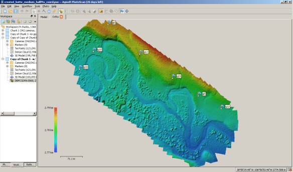
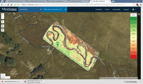
AirCTEMPs now provides unmanned aircraft systems (UAS) to the NSF research community through through our newly formed UAS Federation. The UAS Federation is comprised of 5 collaborating NSF Community Instrument Facilities: CTEMPs, NHERI-RAPID, EarthScope, NCALM and OpenTopography,. Launched in early 2024, the UASFederation.org can now provide comprehensive and state of the art suite of airborne sensors and platforms for the Earth Science and Engineering communities. . At CTEMPs, wefocus on 1-100 sq. km landscapes, and are currently flying a fleet of small drones with the capacity to map topography using SfM, hyper and multispectral cameras and also thermal infrared mapping. Shown below are digital elevation maps generated by AirCTEMPs i and multispectral imagery from the East River near Crested Butte CO showing vegetation density along a riparian corridor. And also, take a look at the cool video of the field site captured during a CUAHSI short course on groundwater/surface water interactions in 2016 Flying over the East River.
For more information, visit the CTEMPs website (http://ctemps.org/air-ctemps)
